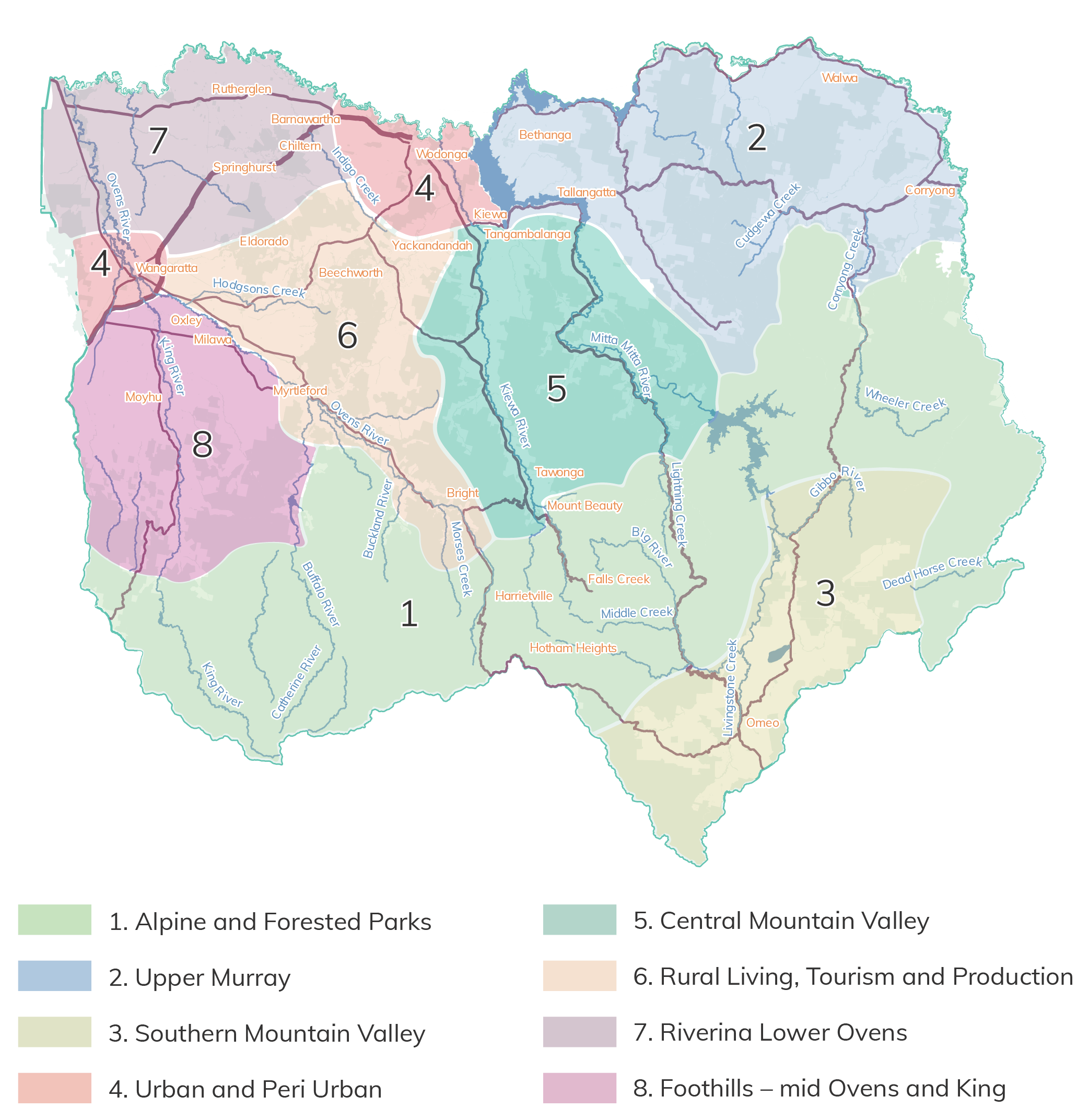
North east Victoria is diverse with a range of features, challenges and opportunities. To understand these on a local scale, information on eight local landscapes is provided.
A full map of the local landscapes can be found in the Region Map tab. These boundaries have been informed by a range of information and data including, socio-economic, geology, bio-regions, geomorphology, topography, land use, hydrology and community characteristics.
Within each landscape the relevant outcomes and priority directions detailed in the thematic sections are identified. Each of the local landscape sections provides information on:
1. Alpine and Forested Parks
Vision: Communities caring for and connecting with healthy forests, alps and waterways
2. Upper Murray
Vision: Connected and climate resilient communities working together to support productive agriculture, recreation, cultural and natural values
5. Central Mountain Valley
Vision: Sustainable land management and recreation thriving alongside healthy forested mountains and waterways
6. Rural living, tourism and production
Vision: Active local and visiting communities supporting sensitive recreation and development that maintains cultural and natural values