North east Victoria covers approximately 1.9m ha, across three major catchments, the Upper Murray, Kiewa and Ovens – but the region is more than just a place on the map. Our breathtaking scenery, rich cultural history, fertile land and natural waterways are some of the reasons why people love and connect with north east Victoria.
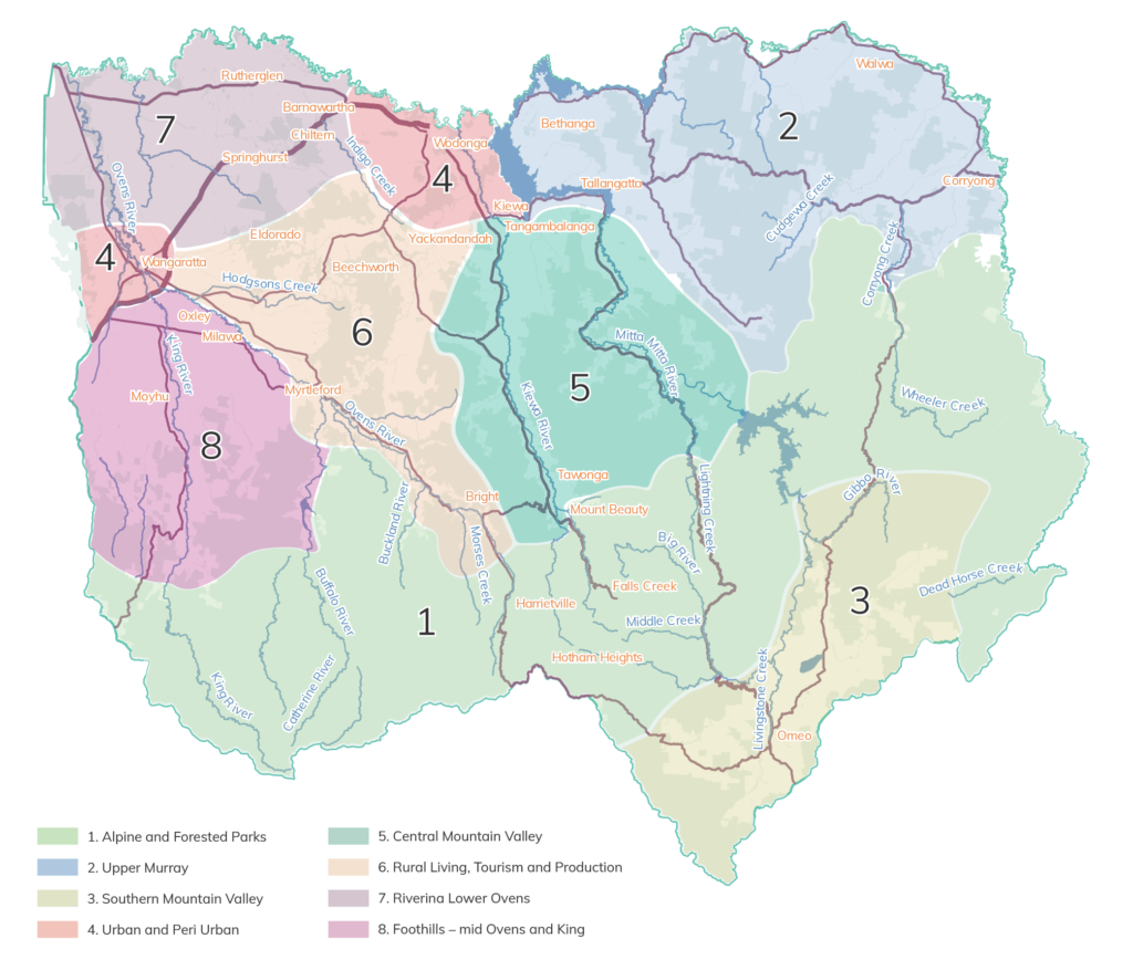
The map below shows the eight local landscapes that have been identified for the purpose of local planning as part of the RCS. These boundaries are informed by a range of information and data including, socio-economic, geology, bio-regions, geomorphology, topograhy, land use, hydrology and community characteristics.